Government & defense · Facility survey

ISP SurveyScan Example capability

LiDAR walk-through to 2D CAD, 3D mesh, and mission exports.

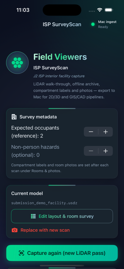
ISP SurveyScan helps military and government survey teams capture interior facilities without existing blueprints. A trained operator uses a COTS LiDAR iPhone or iPad to walk the building, label rooms, photograph building systems, and plan routes — then exports metric floor plans and mission-ready files through Field Viewers ingest and a secure cloud portal.

Surveyor-in-the-loop automation — not unmanned entry into secured facilities.

Metric floor plan with room labels, wall dimensions, and survey route — ISP Demo Residence Site Alpha
2D metric floor plan (demo site)
3D USDZ interior deliverable with dollhouse-style room geometry
3D USDZ deliverable

The problem

  • Traditional ISP-style surveys often need large teams on site for weeks, plus weeks of post-mission processing.
  • Sites may have no prior CAD, degraded communications, and strict data-rights requirements.
  • Teams need 2D plans, 3D context, labeled compartments, building-system documentation, and routing in formats they already use.

What it does

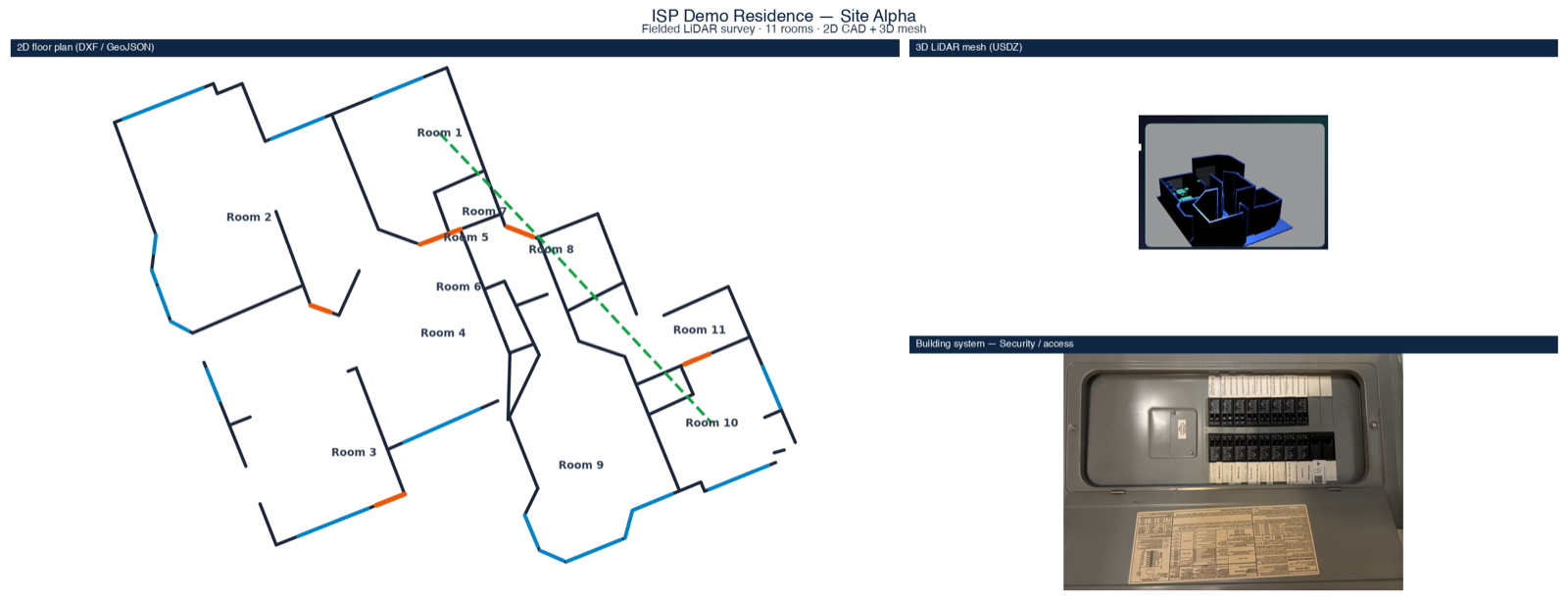
Interior capture through export — built for government survey workflows.

LiDAR capture

RoomPlan-based interior geometry; multi-room, multi-story; works offline.

2D CAD export

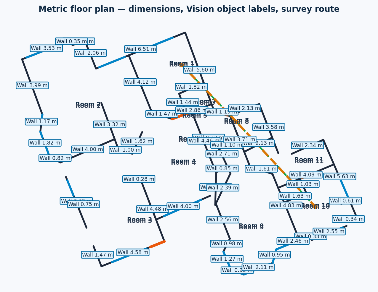
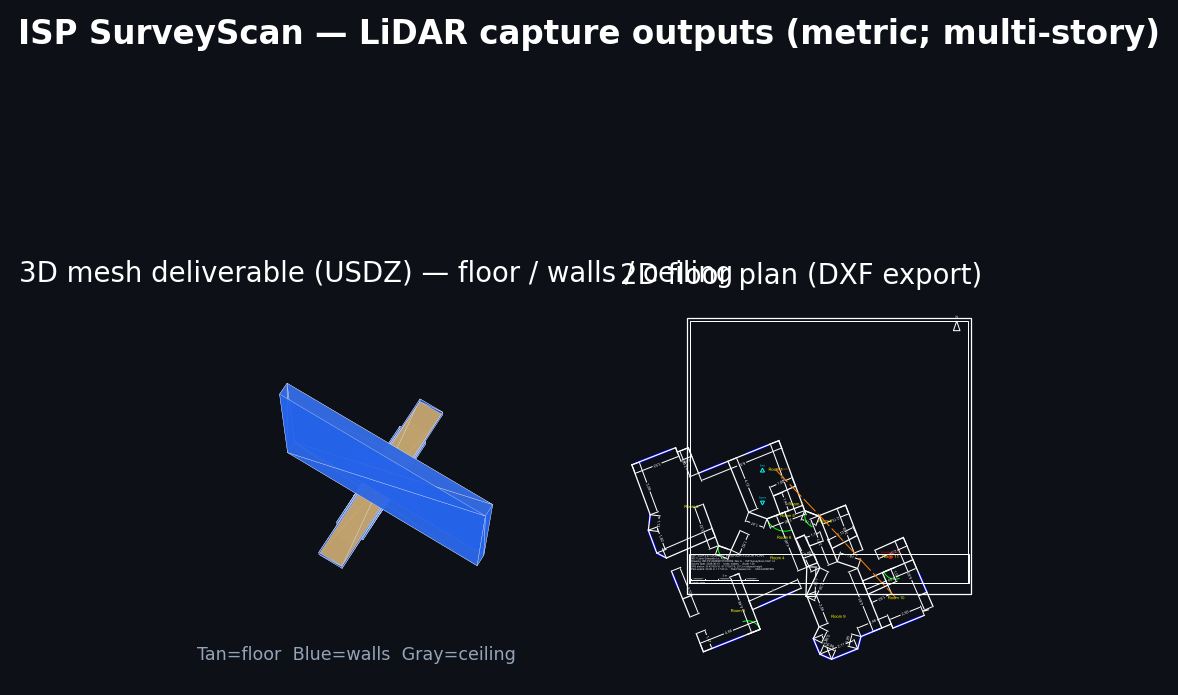
GeoJSON and DXF floor plans with ISP-relevant layers.

3D mesh

USDZ deliverable for review and downstream tools.

Rooms

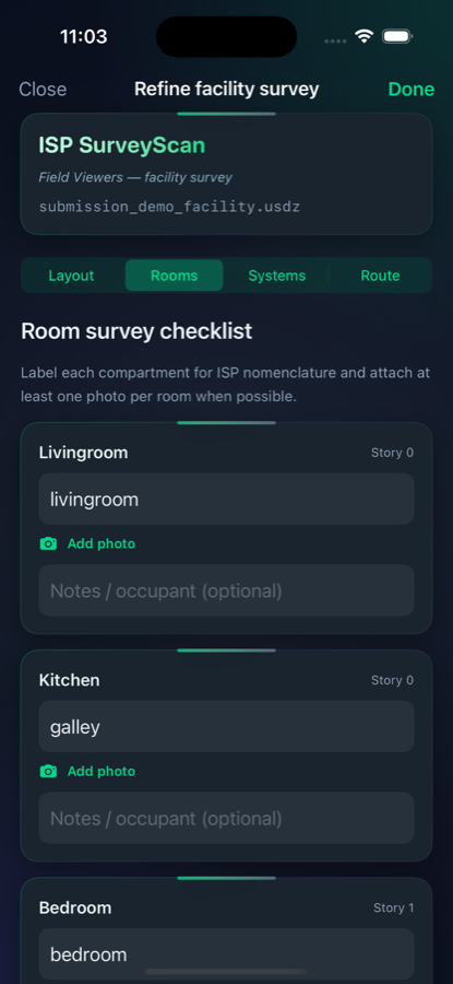
Photograph and label every compartment in a structured checklist.

Auto-label & extract (AI assist)

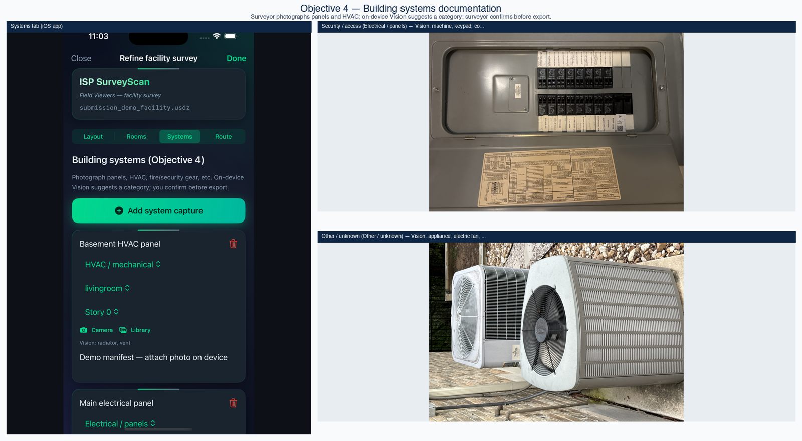
Vision classifies furnishings and building-system photos; confirmed labels flow into DXF/GeoJSON. Surveyor confirms every category. Not fully autonomous.

Building systems

Photograph panels, HVAC, and equipment; Vision-assisted category hints with operator confirmation before export.

Turn-by-turn routing

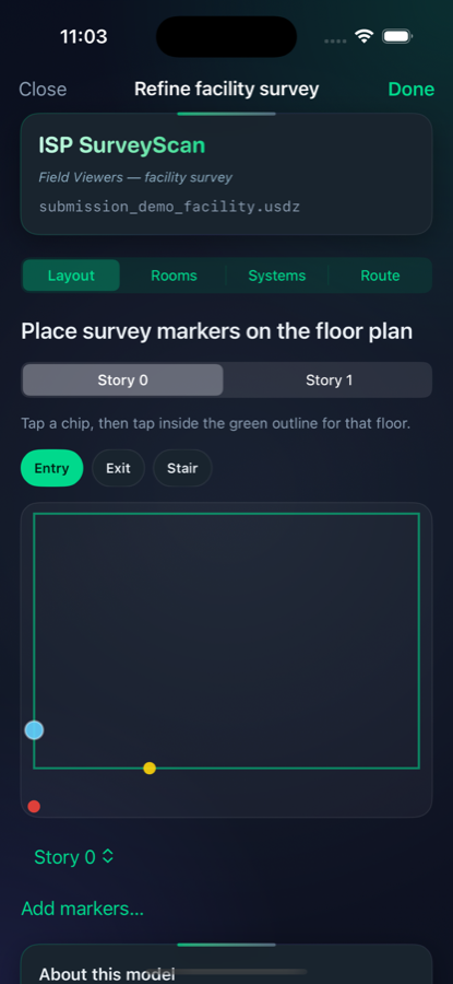
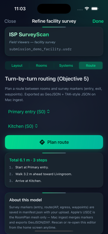
Interior routes on the scanned plan; TAK-compatible route JSON and GeoJSON.

Government cloud portal

Search by site; one view for metadata, map pin, 2D plan, 3D model, and download links (for authorized users).

ISP SurveyScan uses on-device Apple Vision to auto-label furnishings (chairs, tables, beds, appliances) from room photographs and anchor them on the metric floor plan. For building systems, Vision extracts category hints from panel and HVAC photos; the operator confirms before export. Ingest automates CAD layer generation from LiDAR geometry—reducing manual blueprint tracing while keeping the surveyor in the loop.

How it works

  1. Scan Operator completes a LiDAR walk-through on iOS.
    ISP SurveyScan layout tab showing captured floor plan geometry
  2. Annotate Layout, rooms, systems, and route in the field (offline OK).
    Rooms checklist with photographs and labels for each compartment
  3. Ingest Mac or cloud processing produces CAD/GIS/route deliverables.
    Demo deliverables: metric 2D floor plan, 3D LiDAR mesh, and building-system photo
  4. Review & export Team downloads packages from the portal or local ingest.
    Government cloud portal with site search, floor plan, 3D model, and export chips

Field workflow & portal

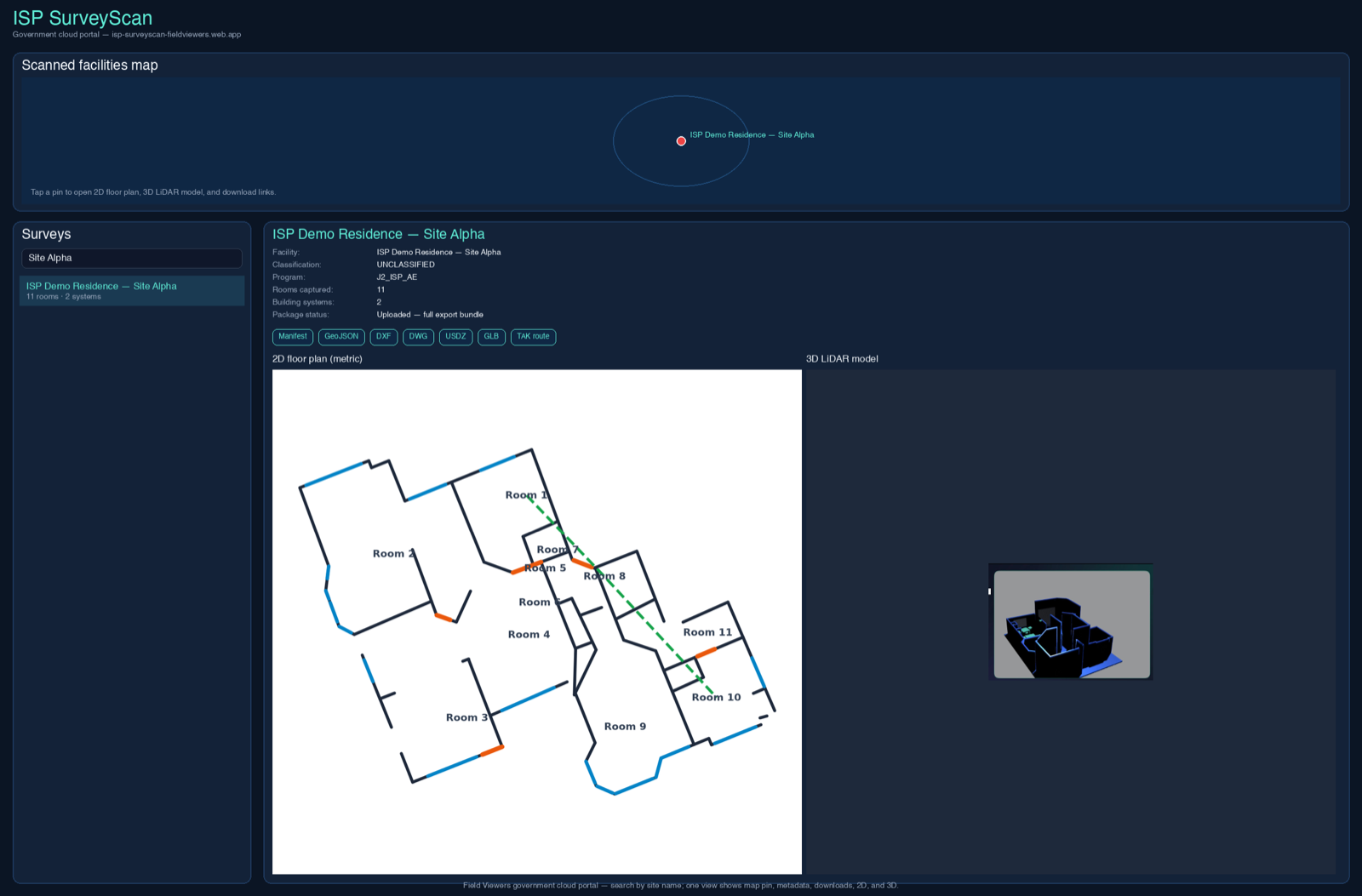
Screenshots from a demo facility (ISP Demo Residence — Site Alpha). No real street addresses or GPS coordinates.

Building systems capture: iOS app with Vision-assisted category hints and panel photographs
Building systems — operator confirms Vision suggestions before export
Turn-by-turn interior route planning on the scanned floor plan
Interior routing — TAK-compatible exports
ISP SurveyScan iOS home screen listing survey workflow steps
iOS operator workflow — offline-capable capture
Technical notes
  • Readiness: Fielded iOS app + ingest; interior capture TRL 6–7 class; export pipeline TRL 7 class (internal assessment).
  • Operators: Government or military surveyors after fielding — Field Viewers provides kit, training, and sustainment under contract.
  • Hardware: COTS Apple LiDAR devices; US procurement; UAV not used in this solution.
  • Data rights: Government purpose rights to survey deliverables; Field Viewers retains application IP (standard federal framing — legal review for contracts).

Request a briefing

Field Viewers Inc., Austin, TX. Tell us your site type, accreditation needs, and deliverable formats.